Op de hoogte van de laatste inzichten
Samenvatting
De conventionele methode voor het uitvoeren van lichttechnische metingen op vliegtuigopstelplaatsen is arbeidsintensief en inefficiënt. Met de verplichting van EASA om vanaf 2024 lichttechnische conformiteit aan te tonen, is behoefte ontstaan aan een snellere, betrouwbare en reproduceerbare meetmethode. Dit onderzoek valideert een innovatieve aanpak waarbij gebruik wordt gemaakt van dronefotografie en beeldverwerkingssoftware om verlichtingssterktes vanuit de lucht te berekenen. Een praktijkproef op Groningen Airport toonde aan dat de afwijking in gemiddelde verlichtingssterkte minder dan 1% bedraagt en de afwijking in gelijkmatigheid beperkt blijft tot 2,7% ten opzichte van handmatige metingen. De resultaten onderstrepen de toepasbaarheid van deze methode als alternatief voor conventionele luxmetingen.
Trefwoorden
drone, luxmeting, vliegtuigopstelplaats, EASA, verlichting, beeldanalyse, validatie
1. Inleiding
Het handmatig uitvoeren van luxmetingen op vliegtuigopstelplaatsen volgens een fijnmazig meetraster is tijdrovend en arbeidsintensief. Grote luchthavens zoals Schiphol ondervinden hierdoor operationele beperkingen bij het naleven van EASA-eisen (EASA, 2023). Eerdere pogingen om met drones op lage hoogte metingen uit te voeren faalden door technische beperkingen zoals GPS-storingen en vluchtinstabiliteit. Dit onderzoek onderzoekt een alternatieve aanpak waarbij luchtfoto’s, genomen op grotere hoogte, worden geanalyseerd om luminantiewaarden te extraheren, met als doel een efficiënte en betrouwbare meetmethode te valideren.
2. Methode
2.1 Voorbereiding
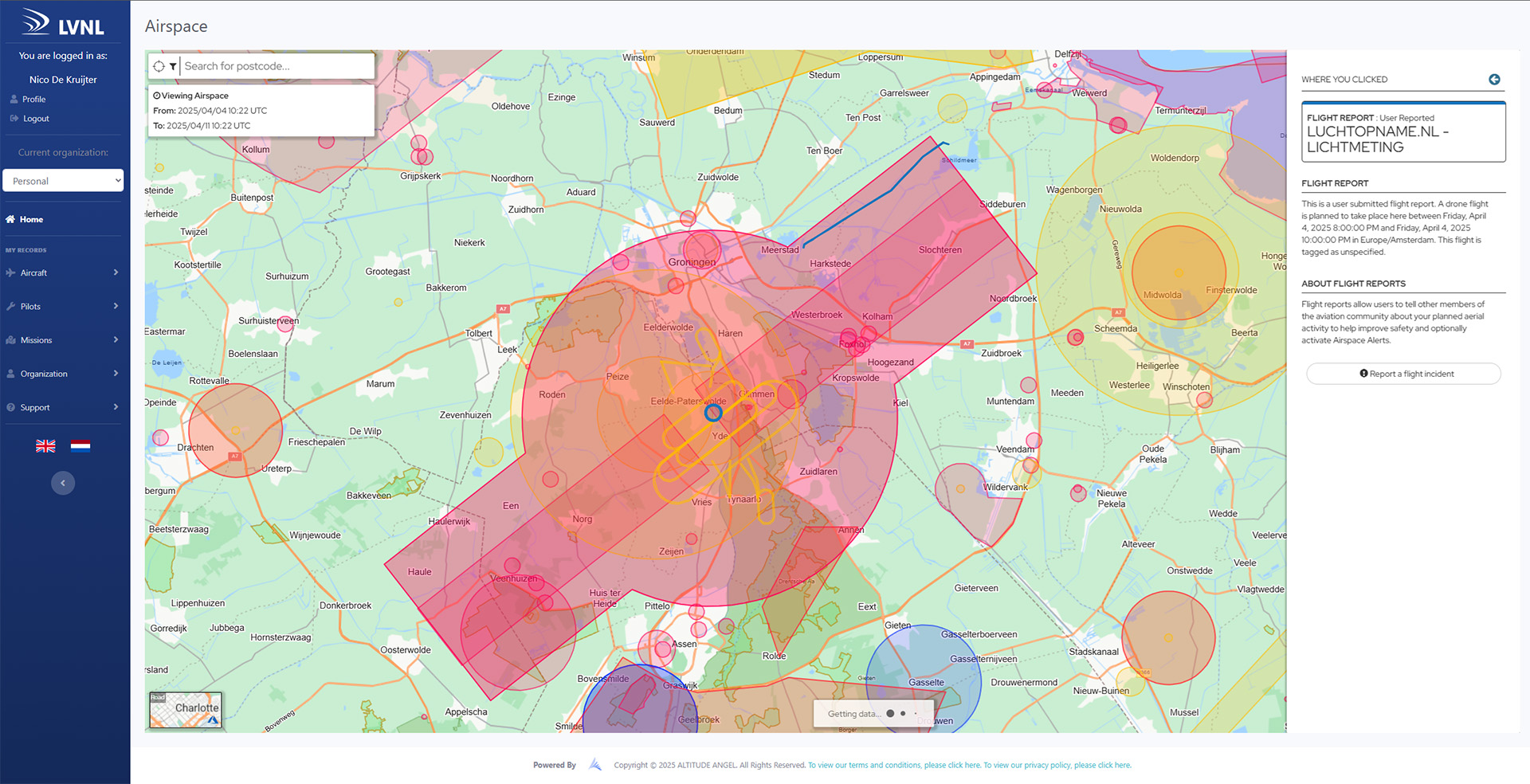
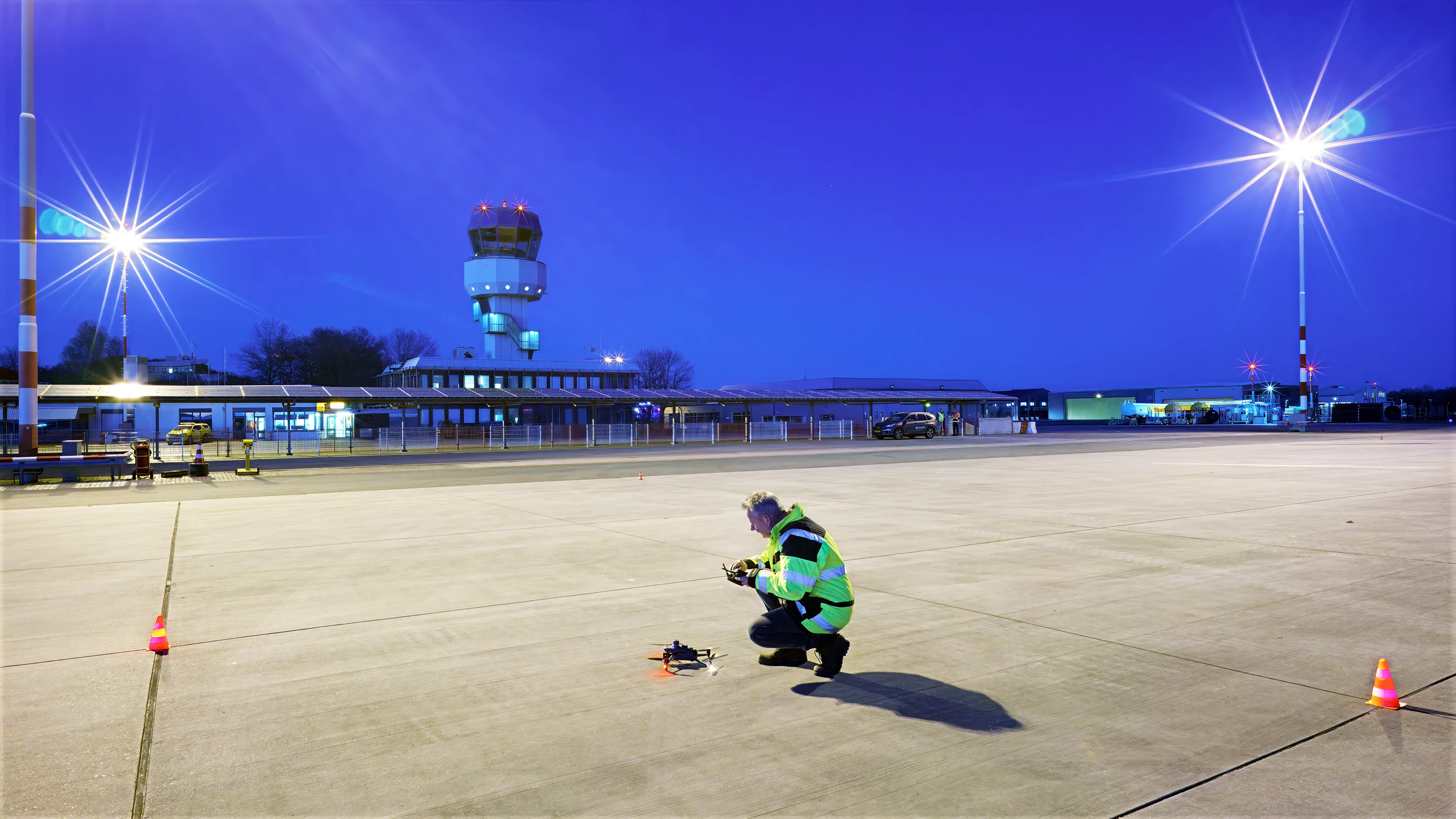
De meting werd uitgevoerd op opstelplaats A15 van Groningen Airport. Een meetraster werd uitgezet conform de richtlijnen van de European Union Aviation Safety Agency (EASA, 2023) en ICAO (2018). Voor de vlucht was toestemming vereist van de luchtvaartautoriteiten. De bemanning bestond uit een dronepiloot met nachtvluchtcertificering, een RT-gecertificeerde radio-operator en een waarnemer. De gebruikte apparatuur omvatte een klasse L luxmeter (NEN, 2014), een gekalibreerde drone (voor spectrale respons, lensvertekening en vignettering), en een laptop voor dataverzameling en -verwerking.
2.2 Dronevlucht en Beeldverzameling
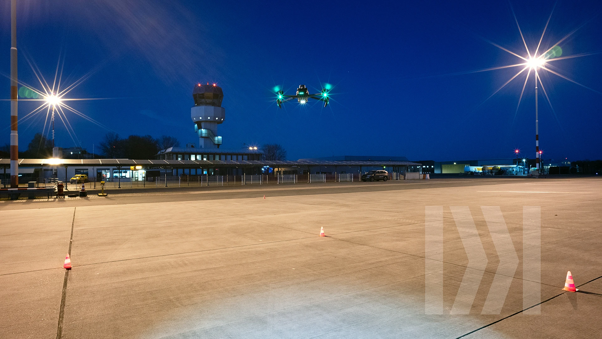
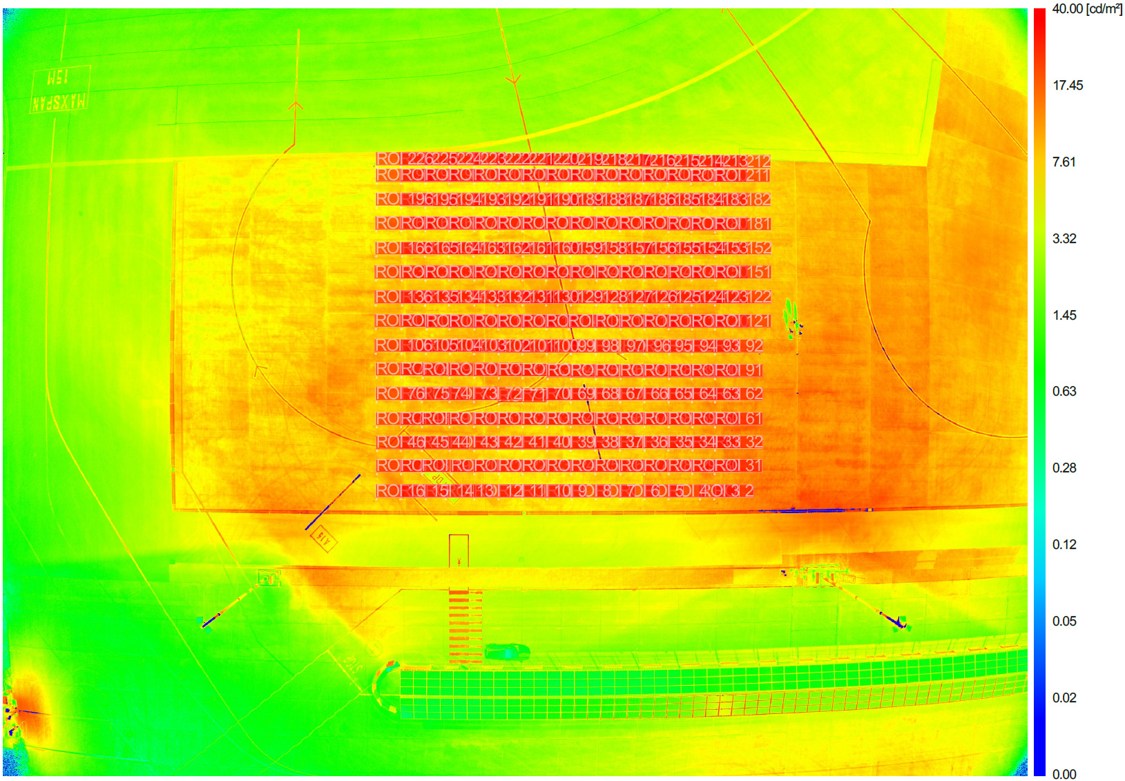
De vlucht werd uitgevoerd met een DJI Mavic 3 Enterprise op een hoogte van 77,7 meter. Beelden werden verzameld met variabele sluitertijden, ISO-instellingen en diafragmawaarden. Analyse vond plaats met software die, op basis van kalibratiebestanden en luminantiecoëfficiënten (CIE, 1984), per meetpunt de luminantie bepaalde.
2.3 Handmatige Meting
Direct na de dronevlucht werden op alle rasterpunten handmatige luxmetingen uitgevoerd, overeenkomstig met de punten op de luchtbeelden.
2.4 Verificatie
De luminantiegegevens vanuit de lucht (in cd/m²) zijn omgerekend naar verlichtingssterkte met behulp van een reflectiecoëfficiënt (Q₀), conform formules zoals toegepast in wegverlichtingsanalyses (CEN, 2015). Deze coëfficiënt werd afgeleid uit een representatief meetpunt op het raster en vervolgens toegepast op de volledige dataset.
3. Resultaten
De gemiddelde afwijking tussen drone-data en handmatige luxmetingen bedroeg minder dan 1%. De afwijking in gelijkmatigheid bleef beperkt tot 2,7%. De dronebeelden bleken stabiel en betrouwbaar op een hoogte van 77,7 meter. Voor grotere vliegtuigopstelplaatsen kan een hogere vlieghoogte vereist zijn.
4. Discussie
De resultaten bevestigen dat drones op grotere hoogte betrouwbare data kunnen leveren voor lichttechnische analyses. Voorwaarden zoals uniforme ondergrond, juiste kalibratie en stabiele vliegomstandigheden zijn cruciaal. De methode biedt aanzienlijke tijds- en kostenbesparing, maar vereist specifieke vergunningen, getraind personeel en goedkeuring van de luchtvaartautoriteiten (ICAO, 2004). Eerdere studies met sensoren op lage hoogte faalden onder meer door verstoringen van GPS-signalen en onnauwkeurige positieherkenning (Mauer, 2009). De validatie werd uitgevoerd op een Boeing 737-opstelplaats; vervolgonderzoek is nodig om de toepasbaarheid bij grotere vliegtuigen zoals de Boeing 777 te bepalen.
5. Conclusie
De gevalideerde drone-gebaseerde meetmethode vormt een effectief alternatief voor handmatige luxmetingen. De methode is snel, reproduceerbaar en nauwkeurig, en bij uitstek geschikt voor grootschalige inspecties op luchthavens. Verdere standaardisatie en validering op andere luchthavens wordt aanbevolen.
6. Referenties
CIE (Commission Internationale de l'Éclairage). (1984). CIE 66: Road surfaces and lighting. CIE Central Bureau.
European Committee for Standardization (CEN). (2015). EN 13201-3: Road lighting – Part 3: Calculation of performance. CEN.
European Union Aviation Safety Agency (EASA). (2023). Certification Specifications and Guidance Material for Aerodrome Design (CS-ADR-DSN). EASA.
International Civil Aviation Organization (ICAO). (2004). Aerodrome Design Manual, Part 4 – Visual Aids (2nd ed., Doc 9157). ICAO.
International Civil Aviation Organization (ICAO). (2018). Annex 14 to the Convention on International Civil Aviation, Volume I: Aerodrome Design and Operations (7th ed.). ICAO.
Mauer, C. (2009, January 14). Messung der spektralen Empfindlichkeit von digitalen Kameras mit Interferenzfiltern [Bachelor’s thesis, Hochschule RheinMain].
Nederlands Normalisatie-instituut (NEN). (2014). NEN-EN 12464-2: Licht en verlichting – Verlichting van werkplekken – Deel 2: Werkplekken buiten. NEN.
Abstract
The conventional method for performing lighting measurements on aircraft stands is labor-intensive and inefficient. With EASA requiring lighting compliance starting in 2024, there is a growing need for a faster, more reliable, and reproducible measurement method. This study validates an innovative approach using drone photography and image processing software to calculate illuminance from the air. A field trial at Groningen Airport showed that the deviation in average illuminance was less than 1%, and the deviation in uniformity was limited to 2.7% compared to manual measurements. The results highlight the applicability of this method as an alternative to conventional lux measurements.
Keywords
drone, lux measurement, aircraft stand, EASA, lighting, image analysis, validation
1. Introduction
Manual lux measurements on aircraft stands using a fine-mesh grid are time-consuming and labor-intensive. Major airports such as Schiphol experience operational constraints in complying with EASA requirements (EASA, 2023). Previous attempts to perform measurements with drones at low altitude failed due to technical limitations such as GPS disturbances and flight instability. This study investigates an alternative approach using high-altitude aerial images to extract luminance values, aiming to validate an efficient and reliable measurement method.
2. Methodology
2.1 Preparation
The measurement was conducted at stand A15 of Groningen Airport. A measurement grid was laid out in accordance with the guidelines of the European Union Aviation Safety Agency (EASA, 2023) and ICAO (2018). Permission was required from air traffic authorities for the flight. The team consisted of a drone pilot with night flight certification, an RT-certified radio operator, and an observer. The equipment used included a class L lux meter (NEN, 2014), a calibrated drone (for spectral response, lens distortion, and vignetting), and a laptop for data collection and processing.
2.2 Drone Flight and Image Collection
The flight was carried out with a DJI Mavic 3 Enterprise at an altitude of 77.7 meters. Images were captured with variable shutter speeds, ISO settings, and aperture values. Analysis was performed using software that, based on calibration files and luminance coefficients (CIE, 1984), calculated luminance per measurement point.
2.3 Manual Measurement
Immediately after the drone flight, manual lux measurements were performed at all grid points, corresponding to the aerial image points.
2.4 Verification
Luminance data from the air (in cd/m²) was converted to illuminance using a reflection coefficient (Q₀), according to formulas applied in road lighting analyses (CEN, 2015). This coefficient was derived from a representative point on the grid and then applied to the entire dataset.
3. Results
The average deviation between drone data and manual lux measurements was less than 1%. The deviation in lighting uniformity was limited to 2.7%. The drone images proved stable and reliable at an altitude of 77.7 meters. For larger aircraft stands, a higher flight altitude may be required.
4. Discussion
The results confirm that drones at higher altitudes can provide reliable data for lighting analyses. Conditions such as uniform surface, proper calibration, and stable flight conditions are critical. The method offers significant time and cost savings but requires specific permits, trained personnel, and approval from aviation authorities (ICAO, 2004). Previous studies with low-altitude sensors failed due to GPS signal interference and inaccurate position recognition (De Kruijter, 2024). The validation was conducted on a Boeing 737 stand; further research is needed to assess applicability for larger aircraft such as the Boeing 777.
5. Conclusion
The validated drone-based measurement method is an effective alternative to manual lux measurements. The method is fast, reproducible, and accurate, making it particularly suitable for large-scale inspections at airports. Further standardization and validation at other airports are recommended.
6. References
CIE (Commission Internationale de l'Éclairage). (1984). CIE 66: Road surfaces and lighting. CIE Central Bureau.
European Committee for Standardization (CEN). (2015). EN 13201-3: Road lighting – Part 3: Calculation of performance. CEN.
European Union Aviation Safety Agency (EASA). (2023). Certification Specifications and Guidance Material for Aerodrome Design (CS-ADR-DSN). EASA.
International Civil Aviation Organization (ICAO). (2004). Aerodrome Design Manual, Part 4 – Visual Aids (2nd ed., Doc 9157). ICAO.
International Civil Aviation Organization (ICAO). (2018). Annex 14 to the Convention on International Civil Aviation, Volume I: Aerodrome Design and Operations (7th ed.). ICAO.
Mauer, C. (2009, January 14). Messung der spektralen Empfindlichkeit von digitalen Kameras mit Interferenzfiltern [Bachelor’s thesis, Hochschule RheinMain].
Nederlands Normalisatie-instituut (NEN). (2014). NEN-EN 12464-2: Lighting of work places – Part 2: Outdoor work places. NEN.
Wij maken licht meetbaar.